GIS & Environmental Impact LEED V04
What is LEED V04..? importance and calculation integrated with GIS tools this will be our lecture to navigate the prerequisites of LEED and its impact on GIS and how to imply it with easy way....
- Location and transportation LT .(depth map tool to evaluate the hierarchy of vessels integrated with GIS )
1- LEED for Neighborhood Development Location (integrated as areas)
2- Sensitive Land Protection. (integrated as areas)
3-Surrounding Density and Diverse Uses. (integrated as density)
4-Access to Quality Transit. (integrated as integer numbers)
5-Bicycle Facilities. ( integrated as integer numbers)
6-Reduced Parking Footprint.(integrated as areas)
7-Green Vehicles.(integrated as integer numbers)
All are integrated on GIS as parameter for outdoor environmental enhancements...
- SUSTAINABLE SITES (SS)
1- Construction Activity Pollution Prevention
2- Environmental Site Assessment
3- Site Assessment
4- Site Development—Protect or Restore Habitat
5- Open Space
6- Rainwater Management
7-Heat Island Reduction
8- Light Pollution Reduction
9- Site Master Plan
10- Tenant Design and Construction Guidelines
11- Places of Respite
12-Direct Exterior Access
13-Joint Use of Facilities
As shown hereinabove 20 prerequisites areas that parameters in GIS to predict and enhance our modelling design.


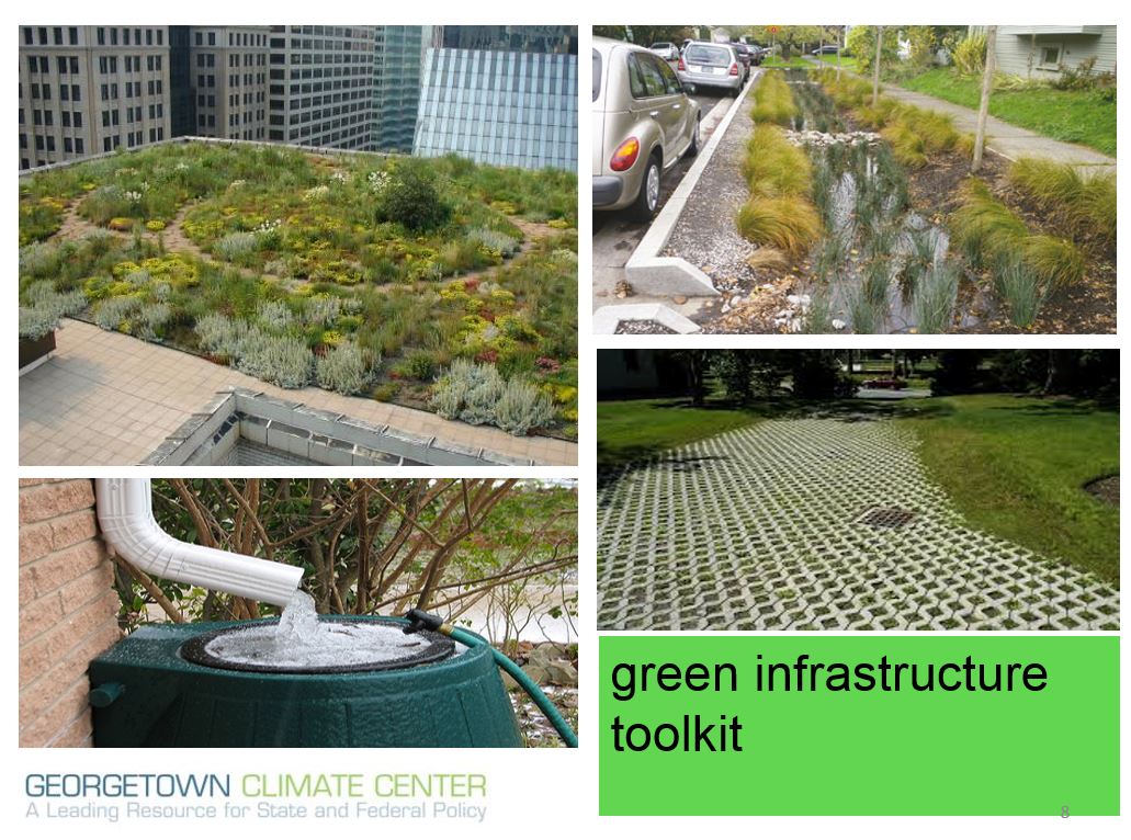
Green infrastructure as main entrance door for LEED

How to design the model that meet the LEED prerequisites of sustainability that is really challenge with GIS can do it with most powerful integration program that clear the intelligibility Depth map ....
Br,
Mohamed Hamdy
@mhamdymabdou

Comments
Post a Comment