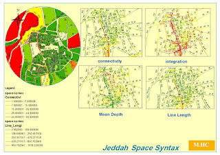
Gis has distinguished input of design quality plan in regards urban planning and design let us first recognize the quality plan process for design discipline:(as ISO 9001) 1- Design review with compatible checklist for technical issue... 2- QC reviewing for all drafting and drawings control regards internal checklist concerning .. 3- Apply all revised plans....( design verification ) 4- Approving for issue .... As mentioned above the 4th design procedures for quality plan is ensure that drawing compatible with technical and control rules , So what is the input of Gis hereinabove,,, GIS input ... - Identify the parameters that shall attached in checklist and compatible with design needs and codes standard .... (Design Validation ) - No mistakes of rules which control with drafting and technical orders...( design verification ) So.. GIS has prominent rule in both Design validation and Verification ... as seen in attached map the output is computerized with fi...


