GIS & Environmental Impact LEED V04
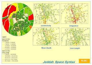
What is LEED V04..? importance and calculation integrated with GIS tools this will be our lecture to navigate the prerequisites of LEED and its impact on GIS and how to imply it with easy way.... - Location and transportation LT .(depth map tool to evaluate the hierarchy of vessels integrated with GIS ) 1- LEED for Neighborhood Development Location (integrated as areas) 2- Sensitive Land Protection. (integrated as areas) 3-Surrounding Density and Diverse Uses. (integrated as density) 4-Access to Quality Transit. (integrated as integer numbers) 5-Bicycle Facilities. ( integrated as integer numbers) 6-Reduced Parking Footprint.(integrated as areas) 7-Green Vehicles.(integrated as integer numbers) All are integrated on GIS as parameter for outdoor environmental enhancements... - SUSTAINABLE SITES (SS) 1- Construction Activity Pollution Prevention 2- Environmental Site Assessment 3- Site Assessment 4- S...
